
Your Complete Guide to Riding Highway 1 on Two Wheels
Why the Pacific Coast Highway is the Ultimate Motorcycle Ride
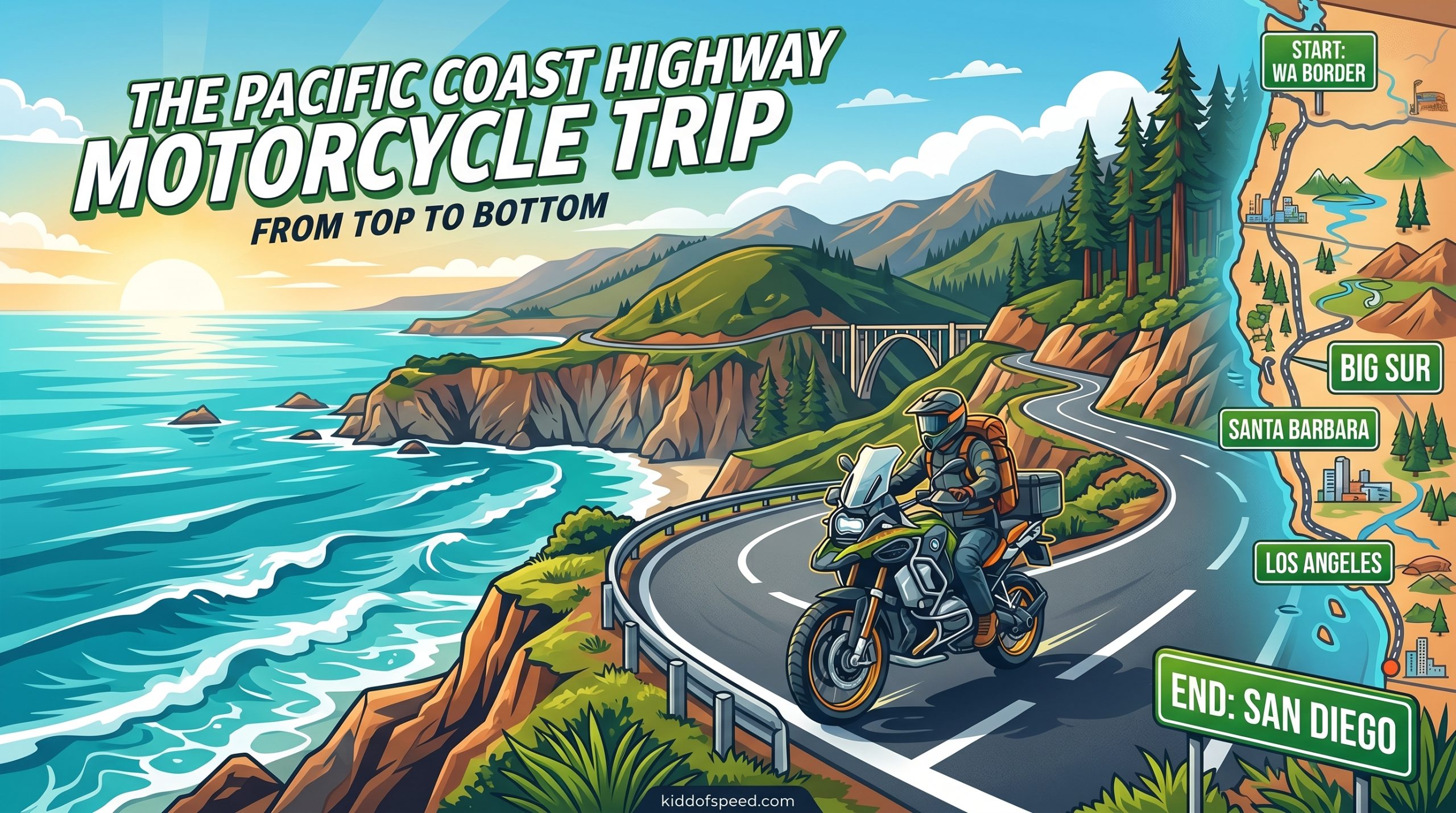
There are few experiences in American motorcycling that rival the pure, undiluted beauty of riding the Pacific Coast Highway from top to bottom. Known locally as Highway 1 or California State Route 1 (SR1), this legendary ribbon of asphalt traces 650 miles of breathtaking coastline from Leggett in Northern California all the way south to San Diego near the Mexican border. For motorcycle riders, it represents the holy grail of American road trips, a bucket-list journey that combines challenging twisties, jaw-dropping ocean vistas, towering redwood forests, and the kind of freedom that only two wheels can provide.
Unlike a car, a motorcycle lets you feel the maritime layer drift across your visor as you climb toward Bixby Creek Bridge, smell the salt spray at Morro Bay, and hear the Pacific crash against cliffs below you. The Pacific Coast Highway motorcycle trip is not just a drive; it is a sensory immersion that connects rider to road and road to sea in a way no other experience can match.
This guide covers everything you need to plan and execute your top-to-bottom Pacific Coast Highway motorcycle trip. We will break down every section of the route, explain the fuel gaps, settle the northbound versus southbound debate, provide a seasonal riding guide, give you a detailed cost breakdown by budget level, and answer all your burning questions. By the end of this article, you will have everything you need to mount up and ride one of the most spectacular roads on Earth.
Route Overview: Top to Bottom Journey
The full Pacific Coast Highway route spans approximately 650 miles of California coastline, though the most iconic stretch for motorcycle riders is the 467-mile segment between San Francisco and Los Angeles. If you are starting from the northern terminus at Leggett (where Highway 1 officially begins at the junction with US Route 101), you can expect to add another 150 miles of spectacular redwood-lined riding before reaching the Golden Gate Bridge.
For planning purposes, most riders break the journey into three to five days of relaxed riding, though experienced touring riders have completed the full route in two intense days. We recommend taking four to seven days to truly savor the experience without rushing through highlights like Big Sur, Monterey Bay, and the Santa Barbara coastline.
| Segment | Approximate Miles | Key Highlights | Suggested Days |
|---|---|---|---|
| Leggett to San Francisco | 150 miles | Redwood forests, Point Reyes, Golden Gate Bridge | 1 day |
| San Francisco to Monterey/Carmel | 120 miles | Half Moon Bay, Santa Cruz, Pacific Grove | 1 day |
| Monterey to San Simeon (Big Sur) | 130 miles | Bixby Creek Bridge, McWay Falls, Nepenthe | 2 days |
| San Simeon to Santa Barbara | 110 miles | Hearst Castle, Morro Bay, Pismo Beach | 1 day |
| Santa Barbara to San Diego | 200 miles | Channel Islands views, Malibu, Los Angeles, San Diego | 1-2 days |
The route generally follows the California coastline, though it dips inland occasionally through mountain passes and Central Valley approaches. Highway 1 is not always a coastal road; in some stretches, it weaves through redwood forests or climbs over coastal mountain ranges before descending back to the ocean. Understanding this variability is key to proper planning, especially when it comes to fuel stops and overnight accommodations.
Section-by-Section Breakdown
Northern California: Leggett to San Francisco
The northern terminus of Highway 1 at Leggett is a modest affair, marked by a small sign where Highway 1 splits off from US Route 101. From here, riders enter one of the most spectacular forest stretches in California. The road narrows and winds through ancient coast redwoods that can exceed 300 feet in height, their canopy forming a living tunnel that feels both ancient and humbling.
The first 50 miles from Leggett to the Mendocino coast are deliberately slow, with speed limits often dropping to 25 mph as the road twists through the redwood groves. This is not a section to rush. Pull off at the various trailhead stops, breathe in the forest air heavy with fern and moss, and remember that the journey is the destination.
Once you reach the Mendocino coast, the road transitions to dramatic coastal bluffs with sweeping views of the Pacific. Towns like Fort Bragg and Point Arena offer opportunities to refuel, both literally and figuratively. Point Reyes National Seashore, just north of San Francisco, is a must-stop with its pristine beaches, historic Point Reyes Lighthouse, and the famous Tomales Bay oyster bars.
Approaching the Golden Gate Bridge from the north on Highway 1 is a iconic moment in American motorcycling. As you crest the hill before Sausalito and the bridge comes into view, you understand why this route has captivated riders for generations. The bridge spans 1.7 miles across the mouth of San Francisco Bay, connecting Marin County to San Francisco proper.
Central Coast: San Francisco to San Simeon
Leaving San Francisco, Highway 1 hugs the peninsula coastline through towns like Pacifica and Half Moon Bay. The Half Moon Bay stretch is particularly popular with surfers and beachgoers, and the famous Maverick’s surf break is visible from certain overlooks when conditions are right.
Pescadero State Beach is a quintessential California coastal stop, with a rocky shoreline, tide pools, and the historic Pescadero general store serving up famous artichoke soup and fresh baked goods. This is the kind of stop that makes a motorcycle trip memorable, so build in time to linger.
Santa Cruz marks the southern end of the peninsula section, offering a vibrant beach boardwalk, classic California surf culture, and the mysterious Monterey Bay just to the south. The 17-Mile Drive near Monterey is a toll road that loops through Pebble Beach and offers some of the most expensive real estate in America, but the coastal views are genuinely priceless.
Monterey and Carmel-by-the-Sea make ideal overnight stops, with world-class aquarium, Cannery Row, and the charming European-inspired architecture of Carmel. From here, you are only about 20 miles from the beginning of the legendary Big Sur section, making this the perfect base camp for exploring one of the most photographed coastlines in the world.
Big Sur: The Crown Jewel
No Pacific Coast Highway motorcycle trip is complete without dedicated time in Big Sur, and for good reason. This 90-mile stretch of coastline between Monterey/Carmel and San Simeon represents the pinnacle of coastal riding in North America. Highway 1 cuts through the Santa Lucia Mountains, clinging to cliffsides that drop hundreds of feet to the crashing surf below, with guardrails that can feel reassuring or terrifying depending on your perspective.
The crown jewel of this section is Bixby Creek Bridge, an iconic arch bridge built in 1932 that appears on virtually every California postcard. The bridge spans 320 feet across a canyon with the Pacific Ocean visible beyond. Pull off at the overlook on the northern side for the classic photograph, but be careful of other vehicles and the constant stream of tourists.
Other essential Big Sur stops include McWay Falls, an 80-foot waterfall that drops directly onto a pristine beach cove in Julia Pfeiffer Burns State Park; Nepenthe, the famous cliffside restaurant and bar with panoramic views; and Point Sur State Historic Park, home to a 19th-century lighthouse.
The terrain in Big Sur is constantly changing. One moment you are riding through dense redwood forest, the next you emerge onto exposed headlands with sweeping views of the Pacific. The road has been rebuilt multiple times following landslides, and you may encounter construction delays or one-way pilot car controls, especially during winter months when mudslides are common.
Fog is a constant companion in Big Sur, rolling in from the ocean often by mid-morning and burning off by early afternoon. Understanding this marine layer pattern is critical for planning your riding schedule and staying safe on blind corners.
Southern California: San Simeon to San Diego
South of Big Sur, the landscape transitions from rugged wilderness to charming Central Coast towns. San Simeon is best known for Hearst Castle, the sprawling estate of newspaper magnate William Randolph Hearst, perched on a hilltop with sweeping views of the coastline. Tours of the castle are available by reservation.
Morro Bay is another popular stop, famous for Morro Rock, a 576-foot volcanic dome that serves as a landmark for sailors and a nesting site for peregrine falcons. The town has a pleasant harbor, excellent seafood restaurants, and motorcycle-friendly accommodations.
Continuing south, you pass through Pismo Beach, Grover Beach, and the resort towns of the Channel Islands coast before reaching Santa Barbara. Santa Barbara’s Spanish architecture, waterfront, and excellent dining make it a perfect rest day destination. The ride through the Santa Ynez Mountains on Highway 154 offers an alternative to the coast highway and delivers its own stunning views of the Santa Barbara countryside.
South of Santa Barbara, the route becomes more urban but no less interesting. The Channel Islands are visible offshore on clear days. Malibu offers world-famous beaches and surf spots, with the Pacific Coast Highway narrowing to two lanes as it threads through expensive beachfront properties.
Los Angeles presents the most challenging traffic conditions on the trip, with the PCH running through Santa Monica and along the South Bay beach cities. Lane splitting is legal in California and can be a practical way to navigate heavy traffic. After LA, the final stretch down to San Diego passes through Oceanside, Carlsbad, Encinitas, and a string of beaches before reaching the border city.
Direction Debate: Northbound vs Southbound
One of the most debated questions among Pacific Coast Highway motorcycle riders is which direction to travel. Both options have passionate advocates, and the truth is that the best direction depends on your priorities, experience level, and what you want to get out of the trip.
Going Northbound (San Francisco to Leggett or LA to SF)
Pros: Many riders prefer northbound because it places the ocean on your left side, giving you unobstructed views of the coastline as you look across your handlebars. The road curves naturally to follow the coast, and your sightlines tend to be better. For photographers, the morning light (if heading north in the morning) illuminates the ocean side. From a psychological standpoint, starting in the south and heading north can feel like you are building toward the dramatic finale of crossing the Golden Gate Bridge.
Cons: If riding from LA, you face LA traffic at the start of your trip when you are freshest and most alert but also dealing with the most stressful conditions. The Big Sur section can feel like it comes too early in the journey if you are on a tight schedule. If you are on a rental bike, many rental locations are in San Francisco or LA, so northbound often means logistics complications.
Going Southbound (Leggett to San Diego or SF to LA)
Pros: Starting in the quieter northern section allows you to warm up on less crowded roads before hitting the busier Central Coast and LA sections. The Golden Gate Bridge crossing at the beginning of your trip creates an immediate sense of adventure and accomplishment. Many riders find that saving the iconic Big Sur section for the middle of their journey gives them something to look forward to and build toward. If flying in to rent, San Francisco rental locations are typically more affordable and have better availability.
Cons: Driving south means the ocean is on your right, and depending on your bike’s seating position, your view of the coastline may be partially obstructed by your own motorcycle. Afternoon sun glare can be an issue heading south in the afternoon. Some riders report feeling more exposed riding with traffic flow when the ocean is on their right.
Our Recommendation
For first-time PCH motorcycle riders, we recommend going southbound from San Francisco. This direction offers the best balance of convenience (easier rental logistics), progressive challenge (building from quieter to busier roads), and dramatic scenery (saving Big Sur for when you are settled into your rhythm). Cross the Golden Gate Bridge at the start, ride through the redwoods and up to Point Reyes on day one, then head south through the central coast toward the highlight of Big Sur.
However, experienced riders who know the route well often prefer northbound for the superior sightlines and ocean views. If you have done this ride before, flip the script and try it from the other direction.
Best Time to Ride the Pacific Coast Highway
Timing your Pacific Coast Highway motorcycle trip correctly is essential. The route passes through multiple microclimates and experiences dramatically different conditions depending on season. Here is a comprehensive seasonal guide to help you plan.
Spring (April to June)
Spring is arguably the best time to ride the Pacific Coast Highway. The days are lengthening, wildflowers bloom along the coastline, and the temperatures are comfortable for riding. In April and May, the fog is less persistent than summer months, and the hills are still green from winter rains. By June, the summer marine layer begins establishing itself, but mornings tend to be clear.
Spring also means fewer tourists than summer peak season, making accommodations more available and popular stops like Bixby Creek Bridge less crowded. Road conditions are generally good, though spring rains can occasionally cause delays from mudslides in wildfire-burned areas.
Summer (July to September)
Summer is peak riding season on the PCH, with the longest days, warmest temperatures, and most reliable weather. However, it also brings the infamous marine layer fog that can roll in daily, particularly in July and August. Morning fog often burns off by noon, but if you are planning to photograph sunrise at Bixby Bridge or ride early, be prepared for limited visibility.
Summer brings heavy traffic, especially on weekends when California residents flock to the coast. Book accommodations months in advance for summer travel. The upside is that longer daylight hours give you more time to ride and explore, and the ocean is warm enough for swimming if you want to take a beach break.
Fall (October to November)
Fall offers a magical combination of conditions. The marine layer diminishes, fog becomes rare, and the summer crowds thin significantly. October is particularly beautiful with warm days, cool nights, and the first autumn storms occasionally creating dramatic cloud formations over the ocean. Waterfall season begins in Big Sur, as October and November rains trigger waterfalls like McWay Falls to flow more vigorously.
The main risk in fall is early-season storms that can bring rain and cause road closures, particularly in the southern Sierra Madre Mountains where Highway 1 passes through burn scar areas vulnerable to mudslides.
Winter (December to March)
Winter is the least recommended time for a Pacific Coast Highway motorcycle trip, though it is not impossible. Storms can bring heavy rain, high winds, and even road closures. The northern section through redwood country is particularly wet and the roads can be slick with fallen leaves. However, winter also offers dramatic ocean storms that photography enthusiasts love, and if you get a string of clear days, you may have the entire highway almost to yourself.
If you ride in winter, be prepared for rain gear, cold temperatures (especially crossing mountain passes), and the possibility of closures. Check CalTrans road conditions before and during your trip. Some riders specifically seek out winter for the dramatic storm watching at places like Hurricane Point in Big Sur.
The Fog Question
Regardless of season, fog is a fact of life on the Pacific Coast Highway, especially between May and August when the marine layer is most established. The fog forms when warm air passes over the cold California Current offshore, creating a temperature inversion that traps cool, moist air at the surface. You will often ride from brilliant sunshine into a wall of fog within minutes.
The solution is simple: ride in the morning, when fog is most prevalent, and plan to be through the worst sections (particularly around Monterey and Big Sur) before noon when the fog typically burns off. Check the National Weather Service marine forecast and monitor fog conditions. Use your low beams (not high beams) when riding in fog, as high beams reflect off the water droplets and reduce visibility.
Fuel Planning and Gas Station Locations
Fuel planning is one of the most critical aspects of Pacific Coast Highway motorcycle trip logistics, particularly in the Big Sur section where long gaps between gas stations can catch unprepared riders off guard. Here is what you need to know to never run dry.
The Big Sur Fuel Gap
The most critical fuel gap on the PCH is between Carmel (the last reliable gas station before Big Sur) and San Simeon (where gas is available on the southern side of the Big Sur region). This gap is approximately 62 miles, and there are NO gas stations between these points. If you are riding a motorcycle with a small fuel tank or poor fuel economy, this gap can be genuinely concerning.
For reference, a motorcycle with a 3-gallon tank and 40 mpg fuel economy will use about 1.5 gallons to cover this distance, leaving you with minimal margin. If you encounter traffic delays, headwinds, or are riding aggressively, your actual range may be significantly less than your theoretical range.
Fuel Stop Reference Table
| Location | Mile Marker | Notes | Recommended? |
|---|---|---|---|
| Leggett | Hwy 1 / US 101 Jct | Last chance before redwoods | Fill up |
| Fort Bragg | ~Mile 35 | Full service available | Fill up |
| Point Arena | ~Mile 65 | Reliable stop | Fill up |
| Tomales | ~Mile 105 | Small station, limited hours | Top off |
| Sausalito | ~Mile 135 | Bridge approach | Not needed from SF |
| Half Moon Bay | ~Mile 155 | Coastal town | Fill up |
| Pescadero | ~Mile 170 | Pescadero Country Store | Top off |
| Santa Cruz | ~Mile 195 | Major town, easy access | Fill up |
| Monterey | ~Mile 225 | Last reliable stop before Big Sur | FILL UP |
| Carmel | ~Mile 235 | Final stop before 62-mile gap | FILL UP – Critical |
| Gorda | ~Mile 270 | Rancho Colibri (small station) | Emergency backup only |
| San Simeon | ~Mile 297 | Hearst Castle area | Fill up |
| Morro Bay | ~Mile 320 | Major town | Fill up |
Fuel Planning Tips
Our recommendation is to run your tank to less than half in Carmel and fill up completely before entering the Big Sur section. This gives you maximum range when you need it most. The Gorda station (mile marker ~270) does exist and is sometimes open, but it should not be relied upon as a primary fuel stop due to limited hours and occasional closures.
Download offline maps through Google Maps or dedicated apps like CalTripRoutes before your trip. Cell coverage is spotty to nonexistent in large portions of Big Sur, so you cannot rely on your phone’s GPS or mapping in real time. Many riders carry a physical California roadmap as a backup.
Consider your motorcycle’s fuel range when planning this trip. If you ride a bike with less than 150 miles of range (like some smaller displacement bikes or those with small tanks), you need to be even more vigilant about fuel planning. For bikes with excellent range (300+ miles), the Big Sur gap becomes much less stressful.
Key Stops and Attractions
While the riding itself is the primary draw for a Pacific Coast Highway motorcycle trip, the route is punctuated with essential stops that should not be missed. Here are the highlights you should plan into your itinerary.
Northern California Must-Sees
- Drive-Thru Tree Park in Leggett allows you to ride your motorcycle through a hollowed-out redwood tree, a quirky and memorable start to your journey.
- Mendocino Headlands State Park offers dramatic coastal bluffs and tidepools in the artistic town of Mendocino.
- Point Reyes National Seashore provides pristine beaches, the Point Reyes Lighthouse, and excellent wildlife viewing including tule elk herds.
- Golden Gate Bridge crossing is a iconic moment; consider stopping at the Vista Point on the Marin side for the classic postcard view.
Central Coast Highlights
- Pescadero State Beach and the adjacent Pescadero General Store for fresh local produce, artisan goods, and one of California’s most photographed lighthouses at Point Pinos.
- 17-Mile Drive through Pebble Beach offers unparalleled coastal scenery including the famous Lone Cypress andghost trees of Pescadero.
- Monterey Bay Aquarium is world-class and a perfect rainy-day activity if weather intervenes.
- Carmel-by-the-Sea is a storybook village with European-inspired architecture, dog-friendly beaches, and excellent dining.
Big Sur Essentials
- Bixby Creek Bridge is the most photographed bridge in California and possibly the entire United States. Morning light is best for photography.
- McWay Falls in Julia Pfeiffer Burns State Park is one of the only waterfalls in California that flows directly onto a beach.
- Nepenthe Restaurant has been serving food and views since 1949. The deck overlooking the Pacific is an essential PCH experience.
- Pfeiffer Big Sur State Park offers hiking trails through redwood groves and along the Big Sur River.
- Point Sur Light Station is a preserved 19th-century lighthouse accessible by tour only.
Southern California Not-to-Miss
- Hearst Castle at San Simeon is one of California’s most famous historical attractions, offering tours of the opulent estate built by media magnate William Randolph Hearst.
- Morro Bay and Morro Rock provide a classic California coastal experience with harbor seals, sea otters, and excellent seafood.
- Santa Barbara Mission and the downtown waterfront represent the best of Spanish colonial California.
- Malibu beaches offer classic Southern California surf culture and beachside dining.
- San Diego completes the journey with balmy weather, excellent Mexican food, and beautiful harbor views.
Safety Tips and Warnings
Riding the Pacific Coast Highway on a motorcycle is an incredible experience, but it is important to acknowledge that this route has real dangers. The combination of narrow roads, cliff-side exposure, frequent fog, tourist traffic, and wildlife means that accidents, some fatal, occur regularly on this route. Here is how to minimize your risk.
Road Hazards
Blind corners are the biggest consistent hazard on Highway 1. Because the road frequently carves through hillsides, you will regularly encounter curves where you cannot see oncoming traffic. The solution is to never cross the center line on curves, assume a car could be around every corner, and ride at speeds that allow you to stop within your sight distance.
Sand and gravel accumulate on the roadway, particularly after winter rains and in shaded areas where moisture persists. Be especially careful through tunnel areas where sand tends to accumulate, and through any section where you see a “falling rocks” sign. A motorcycle sliding on gravel at 30 mph is survivable; the same slide off a cliff is not.
Guardrails on the PCH are often the only thing between you and a very long fall. However, guardrails on older sections of Highway 1 are sometimes inadequate by modern standards. Do not rely on guardrails to save you; treat them as a last resort rather than a safety net.
Traffic and Crowds
The Pacific Coast Highway is a major tourist route, and during peak season, you will share the road with rental cars, RV rentals, bicycles, and pedestrians who may all be unpredictable. The key to managing traffic is patience and flexibility. Leave extra time for your journey so you are not tempted to ride aggressively to make up time.
In urban sections like Santa Monica and Malibu, lane splitting is legal in California and can be a practical way to navigate traffic. However, exercise extreme caution when splitting lanes at high speeds, and never split lanes in stopped or slow traffic where drivers may not expect you. Keep your speeds reasonable when filtering through traffic.
Weather and Visibility
As discussed, fog is a constant companion on the PCH. When visibility drops below 500 feet, pull over and wait if you are not comfortable continuing. Do not try to “power through” fog; the risk of encountering a slow-moving tourist vehicle or a cyclist around every blind corner is simply too high.
Rain is less common in summer but possible any time. Ensure your rain gear is easily accessible, and remember that painted road markings and steel bridge decks become extremely slippery when wet. If you encounter heavy rain, consider pulling off at a scenic overlook and waiting it out rather than pushing through.
Wildlife
Deer are common throughout the route and are most active at dawn and dusk. Elephants seals haul out on beaches at places like Piedras Blancas near San Simeon, and they can wander across the road. Give wildlife a wide berth and never attempt to approach or photograph them in a way that endangers yourself or the animals.
Essential Gear
Beyond your standard motorcycle gear, we recommend bringing: a reflective vest for roadside visibility, extra layers for temperature changes (it can be 30 degrees Fahrenheit different between coastal fog and inland sunshine), earplugs for wind noise on longer sections, sunscreen even on cloudy days (the marine layer does not block UV), and more water than you think you need for the remote sections.
Cost Breakdown by Budget Level
One of the most common questions riders ask is “how much does a Pacific Coast Highway motorcycle trip cost?” The honest answer is that it depends entirely on your travel style, accommodations preferences, and how long you take. Here is a detailed breakdown across three budget tiers for a 5-day, 4-night Pacific Coast Highway motorcycle trip covering approximately 650 miles.
| Expense Category | Budget | Mid-Range | Premium |
|---|---|---|---|
| Motorcycle Rental (5 days) | $200-$350 | $350-$600 | $600-$1,200 |
| Insurance (daily add-on) | $15-$25/day | $25-$45/day | $45-$75/day |
| Fuel (65 cents/mile avg) | $75-$100 | $75-$100 | $100-$150 |
| Accommodation (4 nights) | $60-$100/night | $120-$200/night | $250-$500/night |
| Food (daily) | $25-$40/day | $50-$75/day | $80-$150/day |
| Attractions ( Hearst Castle, etc.) | $30-$50 | $50-$100 | $100-$200 |
| Total Estimate | $600-$1,000 | $1,200-$2,000 | $2,500-$5,000+ |
Budget Tier Details
Budget ($600-$1,000): At this level, you will likely rent an economy motorcycle (250cc-500cc) from a budget rental company, stay in motels or budget hotels, eat at fast food restaurants and grocery stores, and focus on free attractions like beaches and scenic overlooks. Camping is an option that can significantly reduce costs. This tier requires careful fuel planning and skip dining out in favor of self-catering.
Mid-Range ($1,200-$2,000): Mid-range budgets allow for a comfortable touring motorcycle (700cc-1200cc) rental, stays in quality motels and moderate hotels (Holiday Inn, Best Western, Airbnb), eating at decent restaurants for most meals while still hitting some hole-in-the-wall local favorites, and including paid attractions like Hearst Castle tours and aquarium visits.
Premium ($2,500-$5,000+): Premium budgets open up luxury motorcycle rentals (BMW GSA, Harley tourers, Indian Chieftain), stays in boutique hotels, fine dining experiences, and the freedom to stay extra nights in places you love. You might also include guided tour options, motorcycle shipping services, and premium experiences like helicopter tours over Big Sur.
Money-Saving Tips
No matter your budget, these strategies will help you stretch your dollar further: book rental motorcycles months in advance for the best rates; consider shoulder season (May, September, October) for lower accommodation costs and fewer crowds; bring a motorcycle-specific membership (AMA or USRider) that includes roadside assistance; cook some of your own meals; and focus on free attractions which are often the most beautiful anyway.
Frequently Asked Questions
How long does it take to ride the Pacific Coast Highway on a motorcycle?
The full 650-mile Pacific Coast Highway takes approximately 12-14 hours of seat time to ride from Leggett to San Diego. However, most riders break this into 4-7 days to allow for sightseeing, rest stops, and leisurely exploration of highlights like Big Sur. If you are riding just the iconic San Francisco to Los Angeles section (about 467 miles), plan for 3-4 days minimum.
What is the best motorcycle for the Pacific Coast Highway?
Any comfortable, reliable motorcycle is suitable for the PCH. For the full top-to-bottom route, a touring or adventure motorcycle with good wind protection, comfortable ergonomics, and at least 150 miles of range is ideal. Popular choices include BMW GS series, Kawasaki Versys, Yamaha Tracer, Harley-Davidson Electra Glide or Road Glide, and Honda Africa Twin. Smaller displacement bikes are fine for the route but require more vigilant fuel planning.
Is lane splitting legal on the PCH?
Yes, lane splitting is legal in California, and you will encounter it frequently in urban sections through Santa Monica, Malibu, and Los Angeles. When lane splitting, keep speeds under 50 mph, do not split between the two rightmost lanes, and be aware that many car drivers are unfamiliar with or hostile to lane splitters. Use your horn sparingly but decisively to alert drivers of your presence.
Are there gas stations in Big Sur?
There is only one small station in Gorda (sometimes open, sometimes not) between Carmel and San Simeon, a gap of approximately 62 miles. The safe strategy is to fill up completely in Carmel before entering the Big Sur section. Never enter Big Sur with less than half a tank, and ideally start the section with a full tank.
How do you handle fog on the Pacific Coast Highway?
The key to handling PCH fog is timing. Ride in the morning when possible, and plan to be through the fog-prone sections (particularly around Monterey and Big Sur) by noon when the marine layer typically burns off. When you encounter fog, reduce your speed, use low beam headlights (not high beams, which reflect off fog droplets), and pull over if visibility becomes dangerously limited. Stay to the right and trust the edge line to guide you when visibility is very low.
Do I need special riding skills or license endorsements for the PCH?
You need a valid motorcycle license or endorsement for your state or country of residence. No special endorsement is required for Highway 1 specifically, but you should be comfortable with curves, hills, and potentially wet or foggy conditions. If you are a newer rider, consider taking an advanced riding course before attempting the PCH, and never attempt the Big Sur cliff sections if you are not confident in your abilities.
Can I ride the Pacific Coast Highway during winter months?
Yes, but with significant caveats. Winter brings storms, rain, potential road closures, and shorter daylight hours. Some sections, particularly in Northern California and through burn scar areas, are more vulnerable to mudslides and closures. If you ride in winter, check CalTrans conditions daily, carry chains and rain gear, and be prepared for cancellations or route changes. Winter riding can be rewarding for experienced riders who want the roads almost to themselves.
Ready to Ride
The Pacific Coast Highway motorcycle trip from top to bottom is more than a journey; it is a rite of passage for motorcycle riders. Whether you are tracing the redwood-shrouded curves of Northern California, photographing sunrise at Bixby Creek Bridge, or watching the sun set over the Pacific from Malibu, this route offers something no other American road can match.
Plan carefully, respect the road and the ocean, take your time, and remember that the best moments are often the unplanned ones: the oyster bar in Point Reyes, the unexpected elephant seal colony at Piedras Blancas, the hand-painted sign for a hidden beach that only locals know. Get out there and ride.